Geometer Y55G and Professional Mapping in SurPad 4.2
Accurate measurements, cadastre layers and point navigation — built-in GNSS RTK module, no external receivers required
For modern surveying and fieldwork, not only GNSS accuracy matters, but also convenient map handling and measurement tools. Geometer Y55G is a portable controller with the professional surveying software SurPad 4.2 and a built-in GNSS RTK module. This means you don’t need to connect an external GNSS receiver — everything is integrated into one device.
Professional Maps in SurPad 4.2 for Real-World Tasks
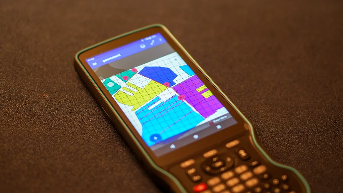
SurPad 4.2 supports different map types and layers, so you can choose the best view for your conditions: fields, windbreaks, built-up areas, roads, or property boundaries.
Standard map — for quick navigation and orientation
Satellite map — convenient for checking field boundaries and objects on site
OpenStreetMap — up-to-date roads, access paths, and settlements
WMS/WFS — connect external GIS services to display cadastre data, parcel boundaries, thematic layers, and vector objects directly in the software
Grid / no-map mode — when maximum readability or reduced data usage is needed
Measurements and Data Display in Real Time
During work, SurPad 4.2 shows your movement on the map and displays coordinates both in measurement mode and during point layout/stakeout. You see the data immediately on the selected map layer — with no extra steps.
Distance and area measurements, contours and boundaries
Working with points: create, view, coordinates, export
Stakeout and navigation to target coordinates
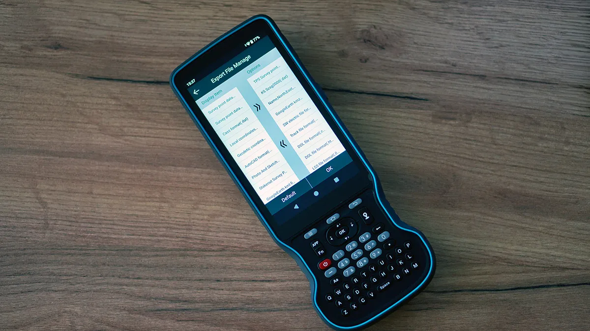
Data import and export — support for common formats: DXF, DWG, SHP, KML/KMZ, CSV. This makes it easy to exchange data with CAD tools, GIS systems, and other surveying workflows
Built-in GNSS RTK Module: No External Receivers or Cables
Unlike solutions where the controller works only as a “screen”, Geometer Y55G has an integrated GNSS RTK module. This means less equipment in the field, faster start-up, and more stable operation.
No need for external GNSS receivers or extra Bluetooth connections
Fewer cables — lower risk of disconnections and link losses
One “all-in-one” system — easier to transport and quicker to start working
Depending on the selected working mode and applied corrections, you can achieve accuracy from about 20 cm with PPP or down to centimeter-level in RTK mode. Choose the mode that matches your task and field conditions.
What Geometer Y55G Is Used For
Field measurement, boundary definition, and area control
Land management and cadastral work (stakeout, point control)
Construction and engineering: project stakeout and geometry control
Precision agriculture: linking field operations and objects to coordinates
Summary
Geometer Y55G + SurPad 4.2 is a professional tool for field mapping and measurements: maps, cadastre layers, stakeout, areas and distances — all with built-in GNSS RTK and no external receivers.